
This article about Natal was adapted from the International Cyclopedia, published in 1889 and as such gives an accurate depiction of the area just before the outbreak of the Boer war with the British Empire.
NATAL. The region now forming the colony of Natal derives its name from its being discovered by the Portuguese on Christmas day 1497. It was visited about 1822 by several white traders from the Cape, who found the country in possession of the Zulu chief Chaka, who ruled in a most sanguinary manner over all the tribes from the Umzimculu to the St. Lucia river. He was killed and succeeded by his brother Dingaan in 1838, but the latter having treacherously murdered a party of emigrant Dutch Boers, who had paid him a friendly visit by invitation to buy land, he was attacked and finally destroyed by the Boers, who at that time had emigrated from the Cape Colony in large numbers, and who made his brother Panda paramount chief in his stead, and then settled themselves down in the country as his lords and masters. The British government, however, now interfered, and, after a severe struggle on the part of the Boers, the country was formally proclaimed a British colony on May 12, 1843, since which time it has progressed very satisfactorily. In 1856 it was erected into a distinct and sperate colony, free from the control of the governor of the Cape. In 1873 Langalibalele, a chieftain of Zulus within the northern frontier, was on suspicion treated very summarily by the colonial government, and banished. The English government decided that the proceedings were illegal, and sir Garnet Wolseley was sent as temporary governor. It was mainly because the security of Natal was menaced by the warlike forces and equipments of Cetewayo, nephew of Dingaan, king of the free Zulus, that the Zulu war of 1879 broke out. Zululand was invaded by the British, and after a fierce defense was finally parceled out amongst various chieftains, nominally independent, but under the supervision of British residents.
The colony of Natal is on the South East coast of Africa, about 800 m. e.n.e. of the cape of Good Hope, between the 29th and 31st parallels of south latitude. Its n.e. boundary is the Tugela or Buffalo river, which divides it from Zululand, and its s.w. boundary is the Umzimculu and Umtamouna rivers. A lofty and rugged range of mountains called the Quathlamba, or Drachenberg, divides it from the Free State and Basutuland, and it contains a well-defined area of 18,750 square miles.
These mountains are composed of a confused mass of granite, gneiss, sandstone, basaltic veins, and shale, and present both the flat top and serrated summits of the chain, of which they are a continuation, so well known in the Cape Colony as the Sneeuwberg and Stormbergen. About lat. 28° 30' these mountains seem to reach their culminating point, and probably attain a height of 10,000 ft., forming a summit line of watershed, from which flow to all points of the compass the waters of the Orange, Umzimvoobo, Vaal, Tugela, and other large South African streams. Towards the coast these mountains present a scarped and almost inaccessible face; towards the interior, however, they gradually die away into the immense rolling plains of the Free State. Many offshoots from these mountains traverse the colony, dividing it into a series of steps or plateaux, gradually rising from the coast region to the foot of the mountains, and fanning so many zones of natural productions.
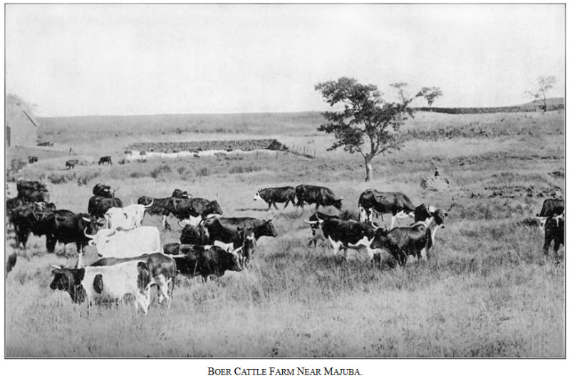
The coast region, extending about 25 m. inland, is highly fertile, and has a climate almost tropical, though perfectly healthy. Sugar, coffee, indigo, arrowroot, ginger, tobacco, and cotton thrive amazingly, and the pine-apple ripens in the open air with very little cultivation. The midland terrace is more fit for the cereals and usual European crops; while on the higher plateau, along the foot of the mountains, are immense tracts of the finest pasturage for cattle and sheep.
The climate is very salubrious; the thermometer ranges between 90° and 38°, but the heat, even in summer, is seldom oppressive. The mean annual temperature at Pietermaritzburg, the capital, is 64° 71'. The winter begins in April and ends in September; the average number of rainy days being 13. In the summer season the thunder-storms are very frequent and severe. The annual rainfall on the coast is about 35 inches. Inland it varies a good deal in different districts, and is greatest in summer. The south-east is the prevailing wind here in the summer months, as in the Cape Colony. Occasionally the sirocco or hot wind from the north-west is felt, which generally terminates in a thunder-storm.
Natal has but one harbor on its coast, and that is D'Urban, or Port Natal, in lat 29° 53'. It is completely landlocked, but a bar prevents vessels above a certain tonnage from entering. There is, however, generally a depth of water on it varying from 9 to 18 feet. There is secure holding-ground in the outer anchorage, The harbor of D'Urban is of great importance to Natal, as it is the only one worthy of the name on the south-east coast. Many extensive engineering operations have been carried on with the purpose of improving the harbor and increasing the depth of water at the entrance. The principal rivers are the Tugela or Buffalo, the Umcomanzi, Umgani, and Umzimculu; like the majority of South African rivers, they are of no use for purposes of inland navigation; but their streams are permanent, and often available for irrigating purposes, thus giving Natal in one very essential point a decided superiority over the Cape Colony.
Coal, copper-ore, iron, and other minerals are found in several places, and there is no doubt that when the great mountain-range is properly explored it will be found very rich in mineral wealth. Large forests of valuable timber abound in the kloofs of all the mountain-ranges, and many tracts along the coast are also well wooded. Natal is divided into the following counties: D'Urban, Victoria, Alexandra, and Alfred on the coast region; Pietermaritzburg, Umcomanzi, and Umroti, central; and Klip River and Weenen at foot of the mountains. The capital is Pietermaritzburg, with about 6,800 inhabitants, on a tributary of the Umgani river, about 50 miles inland. It possesses a large military establishment, and many substantial public buildings. Its name is a compound of the Christian name of Pieter Rietief, and the surname of Gert Maritz, two celebrated leaders of the emigrant Boers who were murdered by Dingaan. D'Urban, or Port Natal, is also a very flourishing town, having a railway connecting the landing-place at Point Natal with the town, and a population of (1881) 14,000. It has two newspapers, and several banks and other public institutions. Verulam, Weenen, Richmond, Newcastle, and Ladysmith are also flourishing towns, and several other new villages have been recently formed.
Natal has a governor aided by an executive council of five; and by a legislative council, consisting of 13 members appointed by government and 15 elected by constituencies. Municipal institutions have been granted to the principal towns. The Anglican, Scottish, Dutch, and other churches exist, and many stations of the Wesleyan, American, Norwegian, and Berlin missions exist. Education is receiving much attention, and schools are multiplying.
The De Beer and Bezuidenlhout passes are the only practicable roads across the mountains, and lead by very circuitous routes across the Free State into Cape Colony; and the numerous mountain streams wanting bridges render internal communication very difficult. Three lines of railway, of a total length of 104 miles, are in course of construction; the chief to connect D'Urban with the capital.
The principal articles of export from Natal are wool, sugar, ivory, and hides. The wool exported to Great Britain in 1875 was valued at £514,310, and weighed 8,328,524 lbs. The total value of exports for the same year was £985,695. The exports comprise cotton, ivory, sugar, coffee, arrowroot, wool, hides, feathers, molasses, and rhinoceros horns. The value of imports in 1875 was £1,268,838. The revenue of the colony in 1880 was £582,715, principally raised from custom duties, transfer dues, and taxes on native huts, etc. In 1843 the value of imports was £11,712, that of exports £1261, while the revenue was only £12,000. Natal's productions were very respectably represented in the great exhibition of 1862, and formed one of the most interesting of British colonial compartments. The population consists of Dutch Boers, who remained in the country after it became a British colony; of English and German settlers; and the remains of the Zulu tribes, who originally possessed the country. It numbered, in 1880, 404,363, of whom 25,271 were whites. The natives possess horses, cattle, sheep, etc., valued at £1,500,000.
The total tonnage of the vessels that entered and cleared the port of Natal in 1875 was 137,227 tons, of which 121,322 were British. The discovery of diamond-fields on the Vaal river is an event in which the colony is deeply concerned.
The large animals are gradually disappearing, although elephants are still occasionally met with in the dense bush of the coast region. Lions, leopards, wolves, and hyenas still hang on the outskirts of civilization. The smaller antelopes are plentiful, and alligators are met with in nearly all the rivers north-east of the Umzimculu. Natal, besides several poisonous snakes, produces a small species of boa, which sometimes attains a length of 16 feet. The hippopotamus is still found near the mouths of the rivers on the eastern frontier.
The botany of this region is of a tropical character. All the timber-trees of the Cape Colony are found here, besides many new ones. The climate of the coast region, however, is too warm for the grape, at least for the purpose of wine-making.